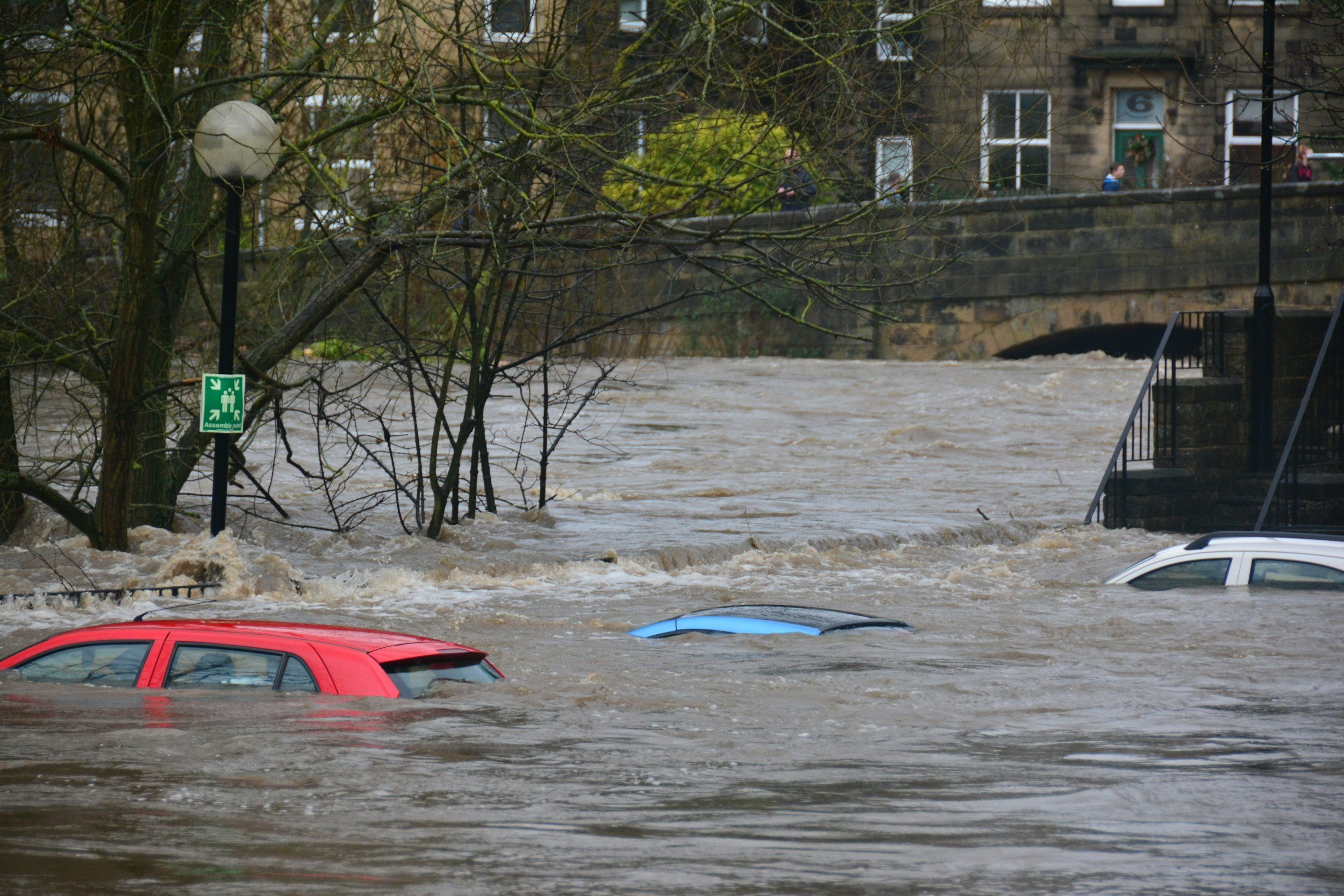
CHARM Online Studio
Collaborative Mapping Platform for Resiliency Planning
-
Overview
Entering resilience planning and hazard mitigation as an entirely new domain, my goal was to understand the complexities of the planning process and design an end-to-end system that empowers users of all technical backgrounds to explore data, build scenarios, and collaborate—without losing the depth of the original tool.
We reimagined how geographic data is discovered, layered, and shared—transforming CHARM from a workshop-supported tool into a self-service, collaborative platform for resilience planning.
-
My role
As Lead Product Designer, I owned discovery, design, and delivery—going beyond visuals to drive alignment across research, product, and engineering. I led foundational research, defined use cases, planned roadmaps, and ran product rituals like sprint planning and backlog grooming.
I also wrote tickets, collaborated closely with GIS and planning specialists, and served as the bridge between stakeholders, devs, and real-world user needs—ensuring we built the right product, the right way.
-
Challenges
A core challenge was bridging the gap between what GIS experts could do and what everyday planning staff actually needed. The legacy CHARM system was powerful but difficult to use without facilitation—making it inaccessible for independent use.
Internally, I also stepped in to define features, triage scope, and manage sprints—while still leading design. It was a high cognitive load, but it gave me a unique opportunity to shape the product holistically, from concept to implementation.
Designing the CHARM Platform
Translating complex mapping data into structured workflows that support analysis, collaboration, and decision-making.
-
Product discovery & problem definition
User research (interviews, usability testing, beta diary study)
UX & systems design for complex mapping workflows
Feature scoping & roadmap planning
Sprint collaboration with engineering
Beta launch planning & validation
Cross-functional alignment (PM, Eng, Data Science, SMEs)
-
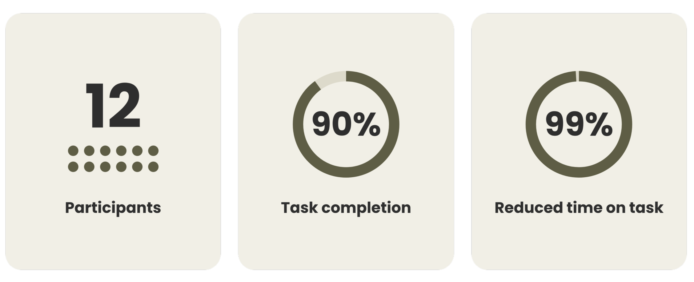
Accelerated mapping workflows from 3–5 days to an average of 10 minutes, dramatically reducing the time required to produce planning outputs.
Brought multidisciplinary teams together through shared geographic context, enabling planners and stakeholders to collaborate, maintain continuity, and pick up where they left off.
Introduced self-service planning as an alternative to facilitated workshops, empowering teams to explore questions independently while retaining access to facilitation when needed.
Expanded the target user base to include consultants, recognizing their central role in facilitating hazard mitigation planning and creating new opportunities to support their workflows.
-
Stakeholders initially focused on recreating in-person workshops online.
I identified an opportunity to look beyond individual workshops and understand the full hazard mitigation planning lifecycle—a process that can span 18 months or longer and involve multiple internal meetings, public engagement sessions, consultants, and regulatory reviews.
I proposed a broader discovery strategy to understand:
How the planning process unfolds from initiation through approval.
Who participates at each stage and how responsibilities shift between teams, consultants, and the public.
How often teams reconvene, what happens between sessions, and where collaboration breaks down.
What requirements drive planning decisions, including funding and approval criteria.
Where CHARM could provide the greatest value throughout the process.
My recommendation was to map the end-to-end planning journey through SME walkthroughs, user research, and real-world workflow observation before determining the next major product investments.
01
Authentication
05
Scenario modeling
02
Role-based access control
06
Collaboration system
03
State management
07
Reporting & exports
04
Data layer orchestration
08
Project structure
Product planning
Before any design work could begin, I curated the foundational artifacts that were missing. I created a central Confluence hub to define the product, outline its goals, and align the team around a shared understanding.
This included drafting the business model canvas and SWOT analysis. I established a north star vision and later refined it based on real user feedback. With the vision in place, I built the product backlog, prioritized features, user story mapping, and led sprint planning. I ran the full beta cycle for MVP, helping the team ship a functional, research-informed platform.
Research and discovery
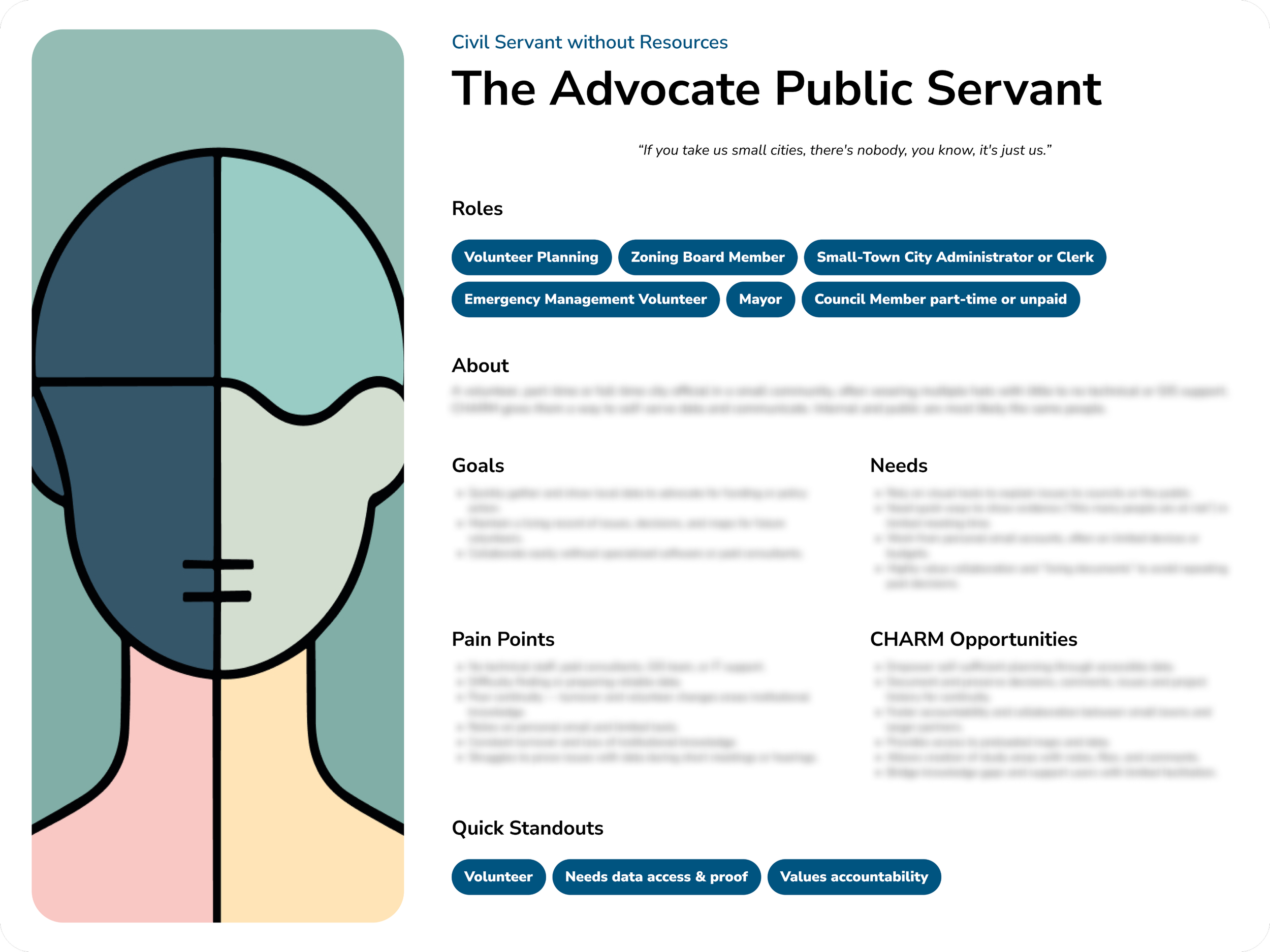
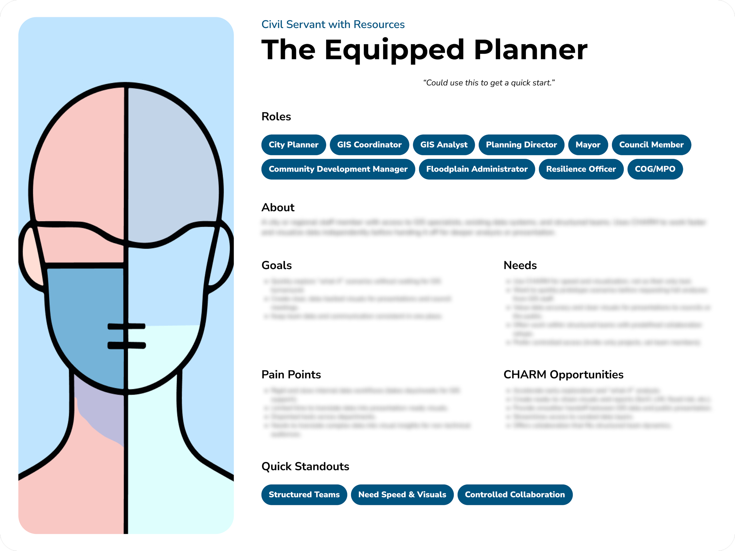
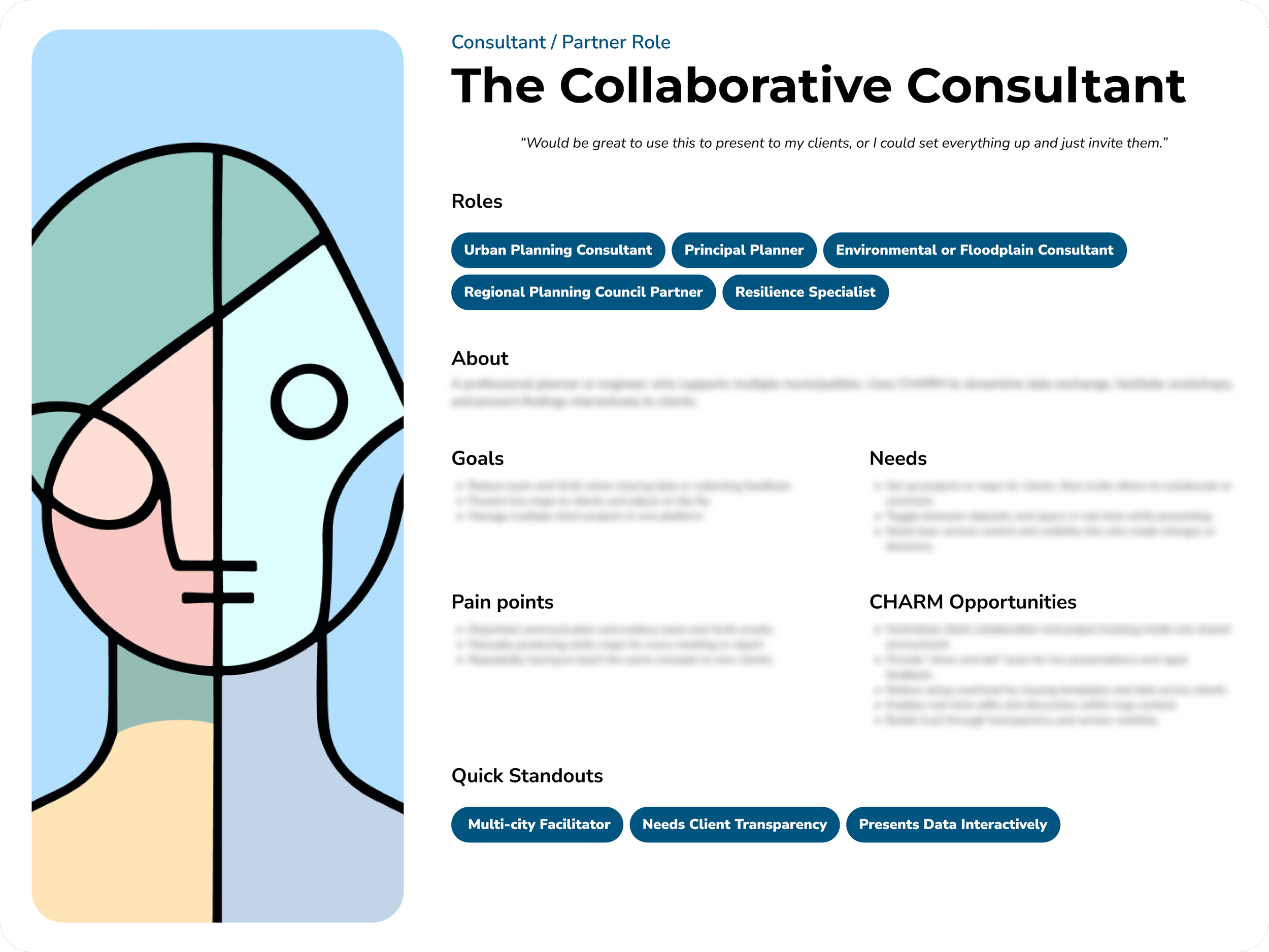
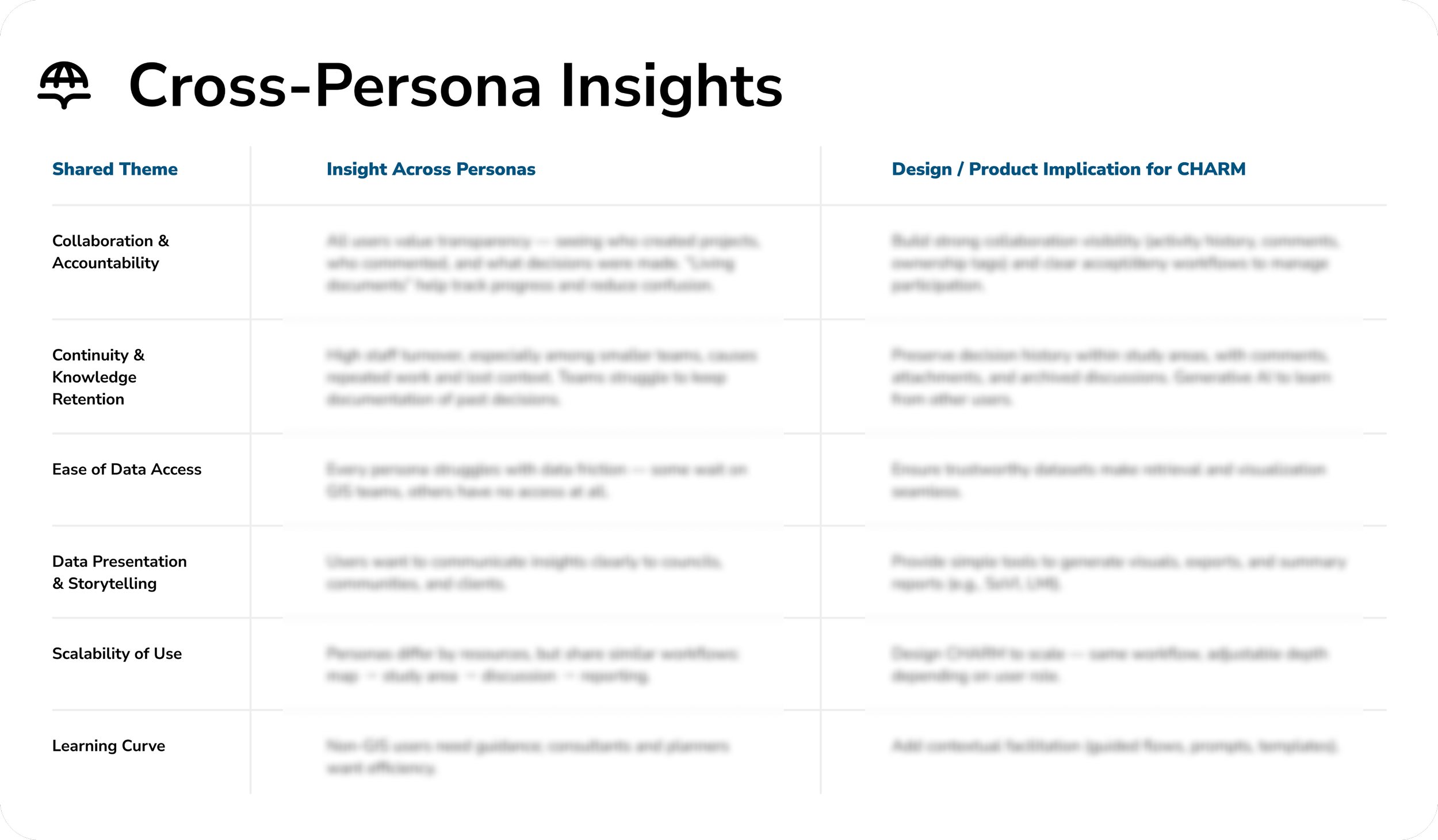
To ground the product in real-world needs, I led stakeholder interviews and remote usability sessions, developing research plans, moderation guides, and synthesis reports. These studies revealed that while users needed fast, reliable access to hazard data, their greatest challenge was collaboration—aligning teams, sharing insights, and maintaining continuity across planning efforts.
Research identified three primary user groups: civil servants with GIS resources, civil servants without GIS resources, and consultants. The greatest opportunity emerged among under-resourced communities—users responsible for critical planning decisions but often operating with limited staff, budgets, and technical support.
“If you take us small cities, there's nobody—we are all volunteers.”
That insight became a guiding principle throughout the product, reinforcing the need for a self-service platform that reduced dependence on technical expertise while making planning more collaborative and accessible.
Research Insights & Product Direction
Users needed collaboration more than mapping.
Many participants could access data but struggled aligning teams around it.
Small communities lacked GIS support.
Many users were responsible for major planning decisions despite limited staff and technical resources.
Planning is ongoing—not event based.
Workshops represented only a small part of the planning lifecycle. Teams needed a place to return, collaborate, and build institutional knowledge over time.
Design
[structure + architecture + clarity]
One of the core challenges was translating complex GIS workflows into something intuitive for non-expert users. Traditional tools rely on layered controls, technical terminology, and fragmented workflows—making them difficult to use without specialized expertise.
I restructured the platform around a simpler mental model:
Projects → organize work around a specific planning effort
Study areas → focus on specific problems or zones within a project
Map views → enable scenario comparison across conditions or time
Each layer of the system has a clear purpose, allowing users to navigate complex data without feeling overwhelmed. This created a shared structure where planners, stakeholders, and collaborators could work from the same foundation with clarity and alignment.
From GIS Complexity → Usable Mental Model
Key Design Decisions & Tradeoffs
[collaboration + structure + workflow]
Designing for non-expert users required carefully balancing simplicity with analytical depth.
Key decisions:
Structuring work beyond the map (focus areas)
Instead of keeping everything at the map level, I introduced focus areas to break large planning problems into smaller, actionable zones—making complex scenarios easier to manage and reason about.Supporting collaboration without clutter (comments)
Rather than relying on external tools or static reports, I embedded commenting directly into map views—allowing users to discuss, annotate, and align within the context of the data.Balancing simplicity and depth
Over-simplifying risked removing critical insights, so I preserved advanced data while guiding users through structured workflows.
These decisions helped transform CHARM from a static map interface into a more structured, collaborative planning environment.
Designing for Decision-Making (not just mapping)
[outputs + insights + action]
Beyond structuring the system, I focused on how users extract insights and make decisions from the data.
Instead of requiring manual analysis, CHARM surfaces key metrics directly from selected map layers—allowing users to quickly understand what’s at risk, compare scenarios, and generate outputs for reporting or stakeholder communication.
This enables:
Real-time visibility into impacts (e.g., homes affected, depth, risk levels)
Faster scenario comparison across map views
Easy export and sharing of insights for reports or presentations
This shifted CHARM from a visualization tool into a decision-support system, where data is not just displayed—but immediately actionable.
From GIS Complexity → Usable Mental Model
[systems + scale + foundation]
To support long-term product growth and evolving use cases, I defined key system-level components that ensure the platform remains flexible and scalable.
Authentication & role-based access to support different user types and collaboration models
State management to handle dynamic map interactions and real-time updates
Data layer orchestration to manage multiple datasets and ensure consistency across views
Scenario modeling workflows to support both current analysis and future planning
This foundation allows CHARM to scale from simple map exploration to more advanced planning workflows—supporting both immediate use cases and future product expansion.
"This is amazing, just having a clear list on how many homes are going to be flooded, and by how much. That’s great. I mean, wow. I know of actual contracts that cost a lot of money just to get this."
- Participant
Outcomes and Reflections
-
Insight
Research showed that planning challenges were rarely about data access alone. Teams needed structure, collaboration, and shared context to make decisions and maintain momentum over time.
-
Outcome
CHARM shifted from a facilitation-dependent process to a self-serve platform where users could explore scenarios, collaborate asynchronously, and preserve institutional knowledge beyond a single workshop or planning event.
-
Reflection
This experience strengthened my approach to product design: validate assumptions early, focus on long-term user behavior, and invest in solutions that support how people actually work rather than how we assume they work.